The Illinois Buyouts Database is the product of collaboration between the Illinois Department of Natural Resources (IDNR) and the Illinois State Water Survey (ISWS). It provides access to digital data about structures in Illinois that have been mitigated through acquisition. The Buyouts Database web map is password-protected. The intended audiences are state and local officials and agency staff; in particular, floodplain managers, mitigation officers, and city planners. It is not intended for use by the general public.
The extent of data varies by area - not all acquisition projects have complete datasets or data coverage. If a community has conducted an acquisition program with their own funds, it may not be represented in this database.
Link to the Buyouts Database web map:
The Illinois Buyouts Database is password-protected. If you work in one of the sectors listed above and would like to request access, please email the Mitigation & Planning group: mitigation@isws.illinois.edu.
See the Illinois Buyouts Database web map at: https://go.illinois.edu/BuyoutsDatabase.
Reports:
The Illinois Buyouts Database was created in 2018 and updated in 2021. The final reports for each of these contracts can be downloaded here:
 Illinois Statewide Property Buyout Database Project 2018 (PDF)
- Illinois Statewide Property Buyout Database Update 2021 (PDF)
Features:
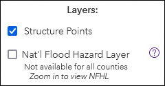
Layer List
Layers available include the structure points and FEMA's National Flood Hazard Layer. Layers can be turned on andoff.
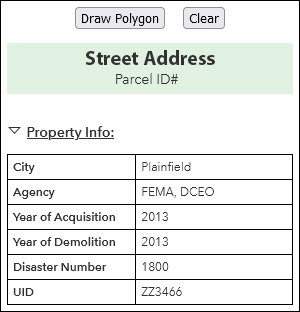
Structure Info Table
View information for an individual structure by clicking on its point. Data availability varies based on the recordkeeping of the original mitigation project.
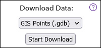
Download
Data shown on the web map can be downloaded, in either GIS or XSLX format.
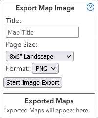
Map Export
A map showing the current view can be exported in a variety of sizes and image file formats.
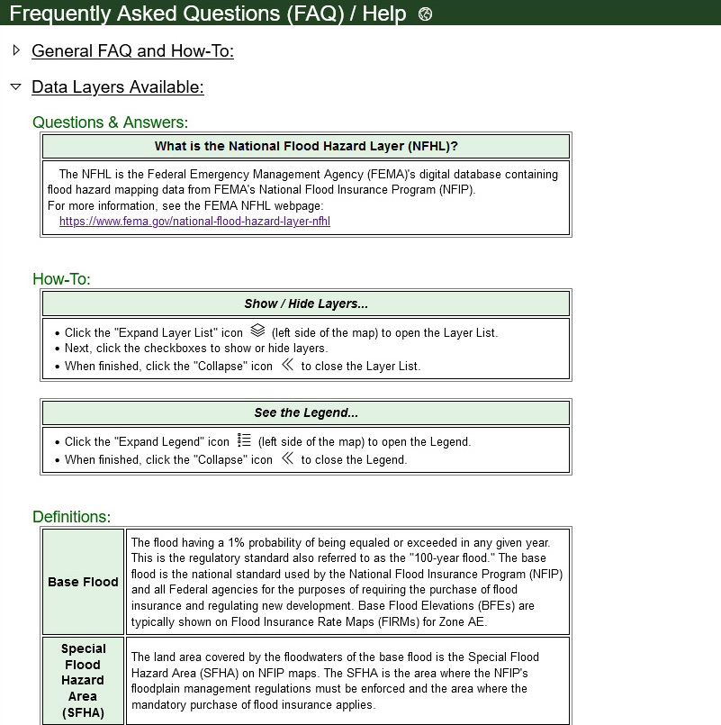
Help/FAQ Page
The Help/FAQ Page includes a variety of topics.