Illinois HUC-8 Watersheds
Click a shaded area on map, or choose a watershed from the sidebar:
Watershed - General Definition
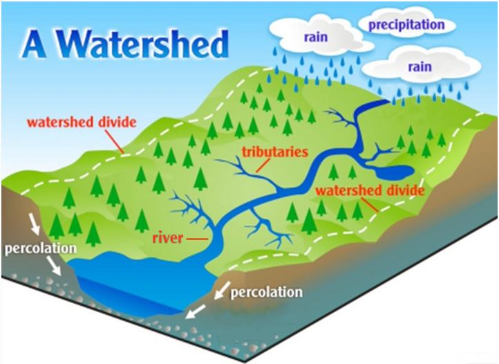
A watershed is an area of land that channels rainfall, snowmelt, and runoff into a common body of water. The term watershed is often used interchangeably with drainage basin.
Original graphic credit: thebrwa.org
Watershed - Specific Terminology
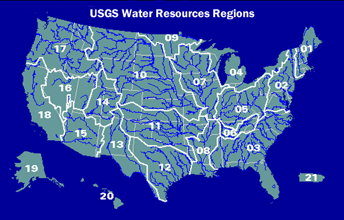
Watershed is a general term; however, the United States Geological Survey (USGS) uses more specific terminology to define drainage areas by size. The US is divided and sub-divided into successively smaller hydrologic units. The first level of classification divides the nation into 21 major geographic areas, or Regions. Most of Illinois is in region 07. For more information, see What is a HUC-8 Watershed on the FAQ.
Original graphic credit: USGS
FEMA Discovery Projects
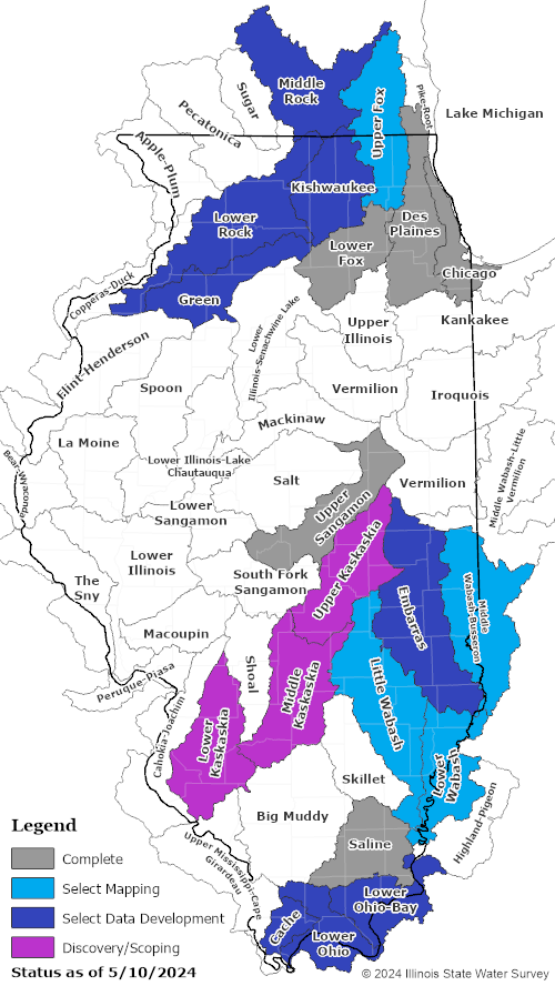
Between 2010 and 2019 the FEMA Risk Mapping, Assessment, and Planning (Risk MAP) program focused on watershed-wide Discovery projects. As part of this program in Illinois, a series of FEMA-defined outreach meetings were conducted within select watersheds to develop a more accurate understanding of flood risk. Collaboration among FEMA, IDNR, ISWS, local communities and other watershed stakeholders was vital to each project's success in identifying, assessing, and communicating flood risk.
Outreach meetings were held at various points during the project timeline to collect information from various stakeholders such as community officials and their staff, floodplain and zoning administrators, engineers, storm water managers, planners, GIS specialists, economic development professionals, emergency responders, and natural resource experts. A subset of Discovery projects proceeded into a data development phase to prepare engineering studies for identified portions of the watershed. A subset of data development projects proceeded into a regulatory mapping phase with the goal of producing countywide digital Flood Insurance Rate Maps (FIRM) where community-based paper maps still existed, as well as updating effective countywide digital FIRMs with new hydrologic and hydraulic studies.
Watershed-based projects completed, or in progress, are colored on the map above.